Welcome to Preston County, WV


Preston County was formed in 1818 and named for James Patton Preston, former Governor of Virginia. The population is approximately 29,300. It is a rather large county, covering 651 miles. During our exploration, Bev and I drove 300 miles. The per capita income for the county is 13,596, with approximately 18% of the population beneath the poverty line.
We visited all towns of Preston, including Albright, Brandonville, Bruceton Mills, Masontown, Newburg, Reedsville, Rowlesburg, Terra Alta, and Tunnelton, and also the county seat and only city, Kingwood. Other unincorporated towns that we visited include Arthurdale, Aurora, Clifton Mills, Corinth, Denver, Eglon, Fellowsville, Hazelton, Hopemont/Hopewell, Independence, Macomber. Yes, we were exhausted after this trip!
The first town we came to on this journey was Masontown. It’s a small town, less than 700  people, and over the years, the town hasn’t changed much. I’ve included an undated photo (black and white though) to show how similar the town looked long ago compared to my snapshot this past weekend. Althou
 gh I haven’t been able to find any history on the town, my guess would be the name comes from the abundance of brick buildings in the town, and there is possibly a brickyard there? More importantly, Masontown is home to the All Good Music Festival, which will be held July 8-11 this year.
 people, and over the years, the town hasn’t changed much. I’ve included an undated photo (black and white though) to show how similar the town looked long ago compared to my snapshot this past weekend. Althou
 gh I haven’t been able to find any history on the town, my guess would be the name comes from the abundance of brick buildings in the town, and there is possibly a brickyard there? More importantly, Masontown is home to the All Good Music Festival, which will be held July 8-11 this year.
Next we arrived in Reedsville. The actual "town" Reedsville is not very big and has a total area of about half a mile. The most important feature of Reedsville seems to be it's four way stop. From here, you can go just about anywhere.
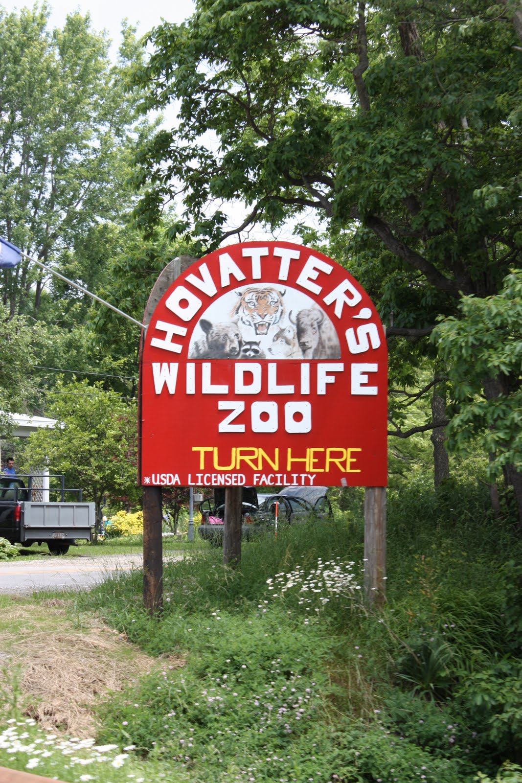
Between Reedsville and Kingwood, a point of interest is Hovatter's Wildlife Zoo, which has bears, monkeys, lions, tigers, you name it!


Kingwood, the county seat and largest city of Preston County, was named for "a grove of big trees." Kingwood is unlike other parts of the county, in that it has numerous stores and fast food restaurants. It is also home to the popular Buckwheat Festival. Bev and I attended the festival last year and enjoyed buckwheat pancakes and great entertainment. Definitely worth checking into. I've added pictures of the main street of Kingwood, along with a side street that shows the architecture of the old bank on the corner, and a small gas station that has been restored.


 We took a wrong turn somewhere near Kingwood, and came across a country club that we didnt know existed. I thought the old oaks were especially beautiful. The country club sits adjacent to Camp Dawson, a training facility for the Army National Guard. I was especially interested in visiting the camp since I had attended a one week program at the facility when I was 13, where I learned to repel, jump from a helicopter lift, and various other things. I was at the camp shortly after September 11th, when security was HIGH and the facility was not a fun place to be..
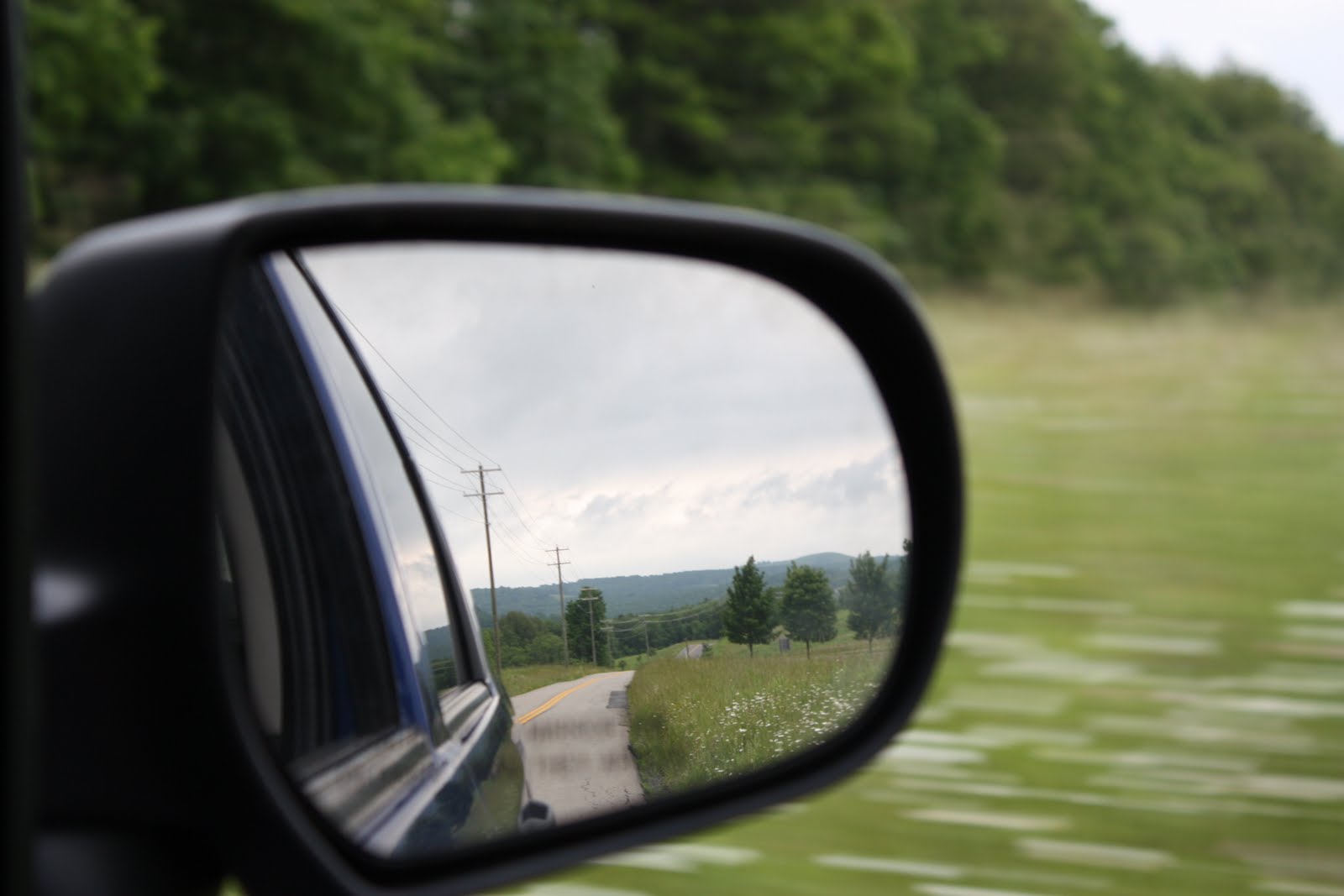
 Terra Alta has got to be the best place to take scenic photographs. Bev and I balanced on top of guardrails to capture these beautiful shots. My favorite is the tall grass with the wooden fence. The scenic picture with the barn was taken in the actual town of Terra Alta. Most of Preston County is made up of "railroad towns".

 An unexpected find came on the outskirts of Terra Alta - the Hopemont State Hospital for the chronically ill, aged, and infirm. It was originally built in 1911 and used as the State Tuberculosis Sanitarium until 1965. This land was apparently chosen for the facility because high altitude and low temperature were thought to be beneficial to TB patients.


 I have to say, I have been pretty impressed with all the restaurants that we have tried while on our trip, but I'm crazy about this place. Donna Jean's Family Restaurant in Aurora, WV is the cutest diner I've ever been in. Bev warned me as we pulled up that it would probably be smoky, she thought it had a bar, etc etc. We were both surprised! The waitress and the cook/owner were the only two inside, the restaurant was very clean, and the food was divine. Bev had a mushroom swiss burger that she wants me to tell everyone, "tasted even better than
  the one Wendy's used to have back in the day". I had a grilled t
 urkey sandwich with lots of fixings.
  Ammmazzzing.
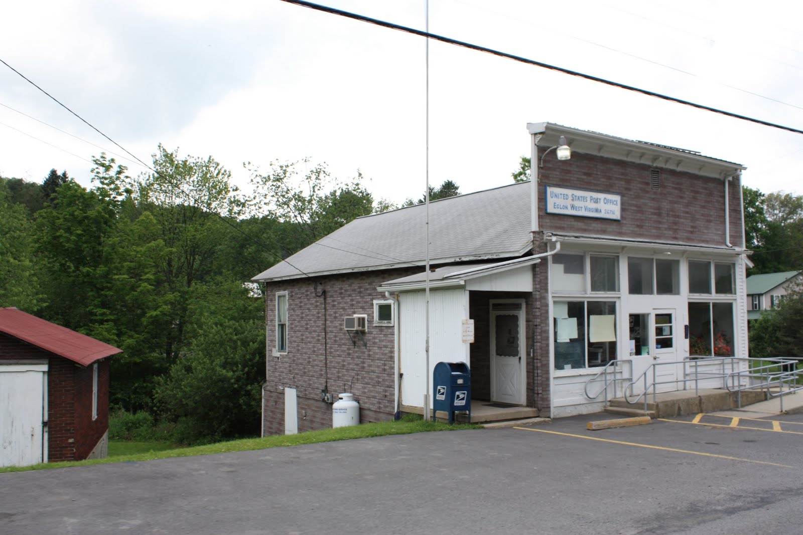

Next, we happened to come to Eglon, the 26716. The zipcode stuck in my mind because the post office is practically the only building there!

Driving down Cheat Mountain though is probably one of my best memories of the day. The mountain has an elevation of 2746 feet and the road down seems to wind forever. Bev and I sang "she'll be coming round the mountain" all the way through..and I caught it on tape!


Another diamond in the rough was the town of Rowlesburg, a cute little town with some very rich history. At the entrance to the town, we found a sign that told a story of how the Confederates were determined to burn the railroad bridge in Rowlesburg. The Union troops, along with the townspeople, dug in and protected "Lincoln's Lifeline" at all costs. There was a caboose on display in the center of town, and a replica of a cannon thought to have been used during the battle. Also, I was impressed that this town has a "Main Street Garden". Although not the best picture, I included it because I got a good laugh when I zoomed in on the gazebo (hint hint, you should too).


 We had dinner in Bruceton Mills, and I wish we could have visited longer. What a cute little town! A mix of old and new businesses and breathtaking scenery. We ate at the near famous Little Sandy's truck stop. Good home cooking, breakfast served all day, and it even offers ostrich burgers! Bev had a buckwheat pancake and I ordered country fried steak. Yummmm good.


 We spent the night at Cheat Canyon Campground in Albright, WV. The campground was beautiful, all level ground, and was only 5 dollars per person. We arrived near dark, so we had to wait until morning to take pictures. Our site was right along the Cheat River. Oh yeah, we both sorta slipped in the mud ;)


Arthurdale, commonly referred to as Eleanor’s Little Village, was created in 1934 as a homestead community. Over a period of four years, 165 homes were built. Each homestead had indoor plumbing and was electrified, and also came with four acres of land for farming. Pictured are one of the original homestead houses, a historic photo of the community center (Library of Congress, FSA-OWI Collection), and what the building looks like today.


 Chuck’s Store seems to be the only business left in Newburg. Another small railroad town, Newburg has a neat memorial for the first big mine shaft explosion in West Virginia. In January of 1886, the mine exploded killing 39 men. With a population of only 360, it’s hard to imagine that Newburg was once the largest town in Preston County. Also, according to the 2000 census records, the per capita income for individuals in the town is $9,952. The town was presumably named Newburg because it was a “new” town being established on the B&O railroad. It is also referred to as “Stop 88” because it is 88 miles from Cumberland, MD.
 The water pollution caused by acid mine drainage is very apparent in streams throughout Preston County. This photo was taken in Fellowsville. The stream is actually much more orange than it appears in the photos.
Tunnelton, yet again another railroad town, was so named for the railroad tunnel that passes through the town. At one time, the tunnel was the longest in the world. I'm curious as to just how BIG the tunnel is because Bev and I failed to find it! We did find the train stations, and some smaller "tunnels". The train station offers a tour, but we were unable to fit it into our schedule.


We drove through Independence, and somehow found ourselves back in Newburg! Pictured here is a church located in Independence. Looks really good for having been built in 1856!


 Bev and I managed to tour Preston County in one weekend, though I think we drove for over 8 hours. In conclusion, Preston is quite a neat place. Beautiful scenery, lots of history, and numerous festivals that make it worth visiting.

4 comments:
So very interesting. I hate to see water ways polluted by industry. I didn't realize just how poor (no negative connotation on the word poor, just using it to mean little money/income) West Virginians are. I realize that they once were, of course, but in today's times I never really considered their position with money. I suppose that's because I am mostly familiar with Jefferson County, which is rich enough to have a casino and horse racing track in it, and if I can't see something with my own eyes or I'm just not aware of it, I can't consider it. It will be interesting what other things I will learn about WV from your travels. Also, I like the new template and I made a picture, the one w/ the grassy field and wire fence, my wallpaper, it's a beautiful shot. Feel free to post more scenic pics in the future. Maybe even some of animals/wildlife or people/store owners/guides. Thank you for this post!
I was really surprised by the orange streams. And from what I read, it sounds like its actually the county that Im living in right now that is causing the drainage into that county's streams!
I know what you mean about not really realizing how the other counties live. That was my point really in doing this trip. I realized that growing up in the eastern panhandle doesnt really give us the "real" WV.
I LOVE the new template too. Thats exactly what I was wanting. Also, blogspot added a new editor, so now you can change the size of the picture, and whether it's left, center, or right on your page after you've already placed it. That is really awesome and great, but the pictures only go where they want to. It's really frustrating. I had sooo many pictures from this trip (700+)..I didnt want to leave any good ones out!
The grassy field/fence picture is my favorite too..I've made it my background! :) Thanks for the comment!
Oh - I really would like to take more pictures of people, but its not really that easy. A lot of these towns look at us like we're "out of towners" and Im unsure whether I'd need release forms or not. I actually have a lot more pictures of houses of the area (some are very sad Steph), but I dont feel like it's right of me to post those on the county site. I want to represent the county in a positive way.. I'd really like to show them to you sometime though.
Hi!
I didn't get a chance to comment last week.
The map is a perfect addition to your blog. I think you will get the picture placement issues sorted out eventually. Everything looks great.
I particularly liked the story about your Grandparents from Albright.
Looking forward to future posts!
My daughter and her husband along with 4 children live in the northern edge of the county. This gave me a good overview of their county. Thank you for the presentation. Steve Owren, Wakefield, RI
Post a Comment